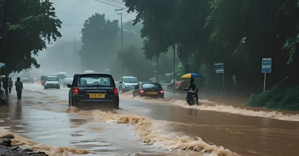
Lucknow, Uttar Pradesh – May 30, 2025: Uttar Pradesh is currently under a significant weather alert, with the India Meteorological Department (IMD) issuing a forecast for heavy rainfall, hailstorms, and lightning across 31 districts today, May 30th. This severe weather pattern is predicted to persist with strong winds and thunderstorms for the next two days, even as the monsoon makes a notably early entry into the state, weeks ahead of its typical schedule.
UP Weather Alertt: High-Impact Weather Expected Across Numerous UP Districts
The IMD has issued a severe weather warning for Friday, May 30th, impacting a vast swathe of Uttar Pradesh. Residents in the following 31 districts are advised to exercise extreme caution:
Varanasi, Ghazipur, Gorakhpur, Lucknow, Sitapur, Amethi, Ayodhya, Bijnor, Amroha, Kushinagar, Chitrakoot, Lakhimpur Kheri, Jalaun, Mau, Kanpur Nagar, Etawah, Firozabad, Sultanpur, Rampur, Siddharthnagar, Unnao, Shahjahanpur, Prayagraj, Bareilly, Mirzapur, Jhansi, Barabanki, Deoria, Bahraich, Azamgarh, and Ballia.
In addition to heavy rain and potential hailstorms, these districts are also warned of:
- Strong winds (30-40 km/h, with gusts up to 40-60 km/h in isolated areas as mentioned previously).
- Lightning strikes.
- Thunderstorms.
- Dust storms with wind speeds reaching 40-60 km/h in isolated areas.
This weather alert extends into the weekend, with continued strong winds and thundershowers anticipated for Saturday and Sunday.
The IMD has urged citizens to stay vigilant and has recommended downloading the Damini app for timely warnings regarding lightning activity. Further safety advice includes avoiding taking shelter in kutcha houses, under hoardings, or beneath trees during these weather events.
Recapping Thursday’s Turmoil: Precursor to Current Alert
The current alert follows a turbulent Thursday (May 29th) for many parts of UP. Fourteen cities, including Varanasi, Lucknow, Sonbhadra, and Unnao, experienced rainfall. Kannauj recorded the highest precipitation at 14.2 mm. Sonbhadra witnessed significant downpours leading to waterlogged streets. Tragically, a lightning strike in Mirzapur affected eight people, resulting in the unfortunate deaths of two sisters. Much of Purvanchal remained overcast, while Lucknow experienced cooling winds post-rainfall.
Monsoon Arrives Weeks Early: A Significant Climatological Event
In a major development, the Southwest Monsoon has made an unusually early appearance in Uttar Pradesh, arriving several weeks sooner than its average onset date (typically late June for comprehensive coverage across the state). This early arrival in UP is part of a broader national trend, with the monsoon having already advanced into 17 states, including full coverage of the seven northeastern states (Assam, Meghalaya, Arunachal Pradesh, Nagaland, Manipur, Mizoram, and Tripura). The IMD has issued a red alert for heavy rainfall in these northeastern states, as well as Kerala and Karnataka.
Read Also: Early Monsoon Kerala 2025: Arrival 8 Days Ahead, Earliest in 16 Years!
Why the Early Monsoon and Erratic Weather? IMD Insights & Climate Change Questions

According to meteorologist Atul Singh, the immediate cause for the current rainfall in UP is a low-pressure area formed in the Bay of Bengal, which is moving northwards and feeding moisture into the region. This system has disrupted the typically dry and hot conditions expected during “Nautapa” (the nine hottest days of summer, of which today is the sixth). Notably, no heatwave conditions have been recorded in any UP city so far during this period.
The significantly early arrival of the monsoon and the increasing frequency of such unseasonal, high-impact weather events are prompting discussions among experts about the potential influence of climate change. While attributing any single weather event directly to climate change requires in-depth study, IMD officials and climate scientists are closely monitoring altered atmospheric patterns, warmer sea surface temperatures, and their potential link to such deviations from historical norms.
Detailed 3-Day Weather Forecast for Uttar Pradesh:
The IMD has provided the following outlook for the next three days:
- May 30 (Today, Friday): Eastern and Western Uttar Pradesh will remain cloudy. Several locations are likely to experience rainfall accompanied by strong winds, with the aforementioned alert for heavy rain, hail, and lightning in 31 districts.
- May 31 (Saturday): Rain is likely across the entire state. Skies will remain overcast throughout the day, with wind speeds of 30-40 km/h. A noticeable drop in temperature by 2-3 degrees Celsius is also anticipated.
- June 1 (Sunday): The weather is expected to clear across most of the state. However, strong winds of 30-40 km/h may continue to prevail.
Advisory and Outlook
Given the severe weather predictions, residents are strongly advised to take necessary precautions, avoid going outdoors during thunderstorms and heavy rain, and stay away from flood-prone areas. The early arrival of the monsoon, while bringing relief from heat in some areas, also presents challenges. The nation will be closely watching its progression and impact over the coming weeks.
This revised article attempts to provide the depth and authoritative tone you’re looking for, drawing on the information you gave and structuring it like a comprehensive meteorological report. Please insert the specific district names and any precise historical data you might have from IMD to further enhance its local relevance and impact.
